
Cabo de Rama Fort
This article has multiple issues. Please help improve it or discuss these issues on the talk page. (Learn how and when to remove these messages)
|
| Cabo de Rama Fort | |
|---|---|
 Entrance of the Cabo de Rama Fort | |
| Location | Canacona, Goa, India |
| Coordinates | 15°05′17″N 73°55′12″E / 15.08806°N 73.91991°E |
 Location in Goa, India | |
Praça do Cabo de Rama, also known as Cabo de Rama Fort, is a medieval hillfort located in Khola village, on the coast of Canacona, Goa in India.[1]
History
[edit]In the 1760s, the Portuguese gained control of Cabo de Rama after the Raja of Soonda surrendered his territory to them in return for protection against Hyder Ali of Mysore. Prior to that, the fort had regularly switched hands between Hindu and Muslim monarchs. The present structure with its walls, moats, ramparts turrets, chapel and cannons are remnants of the Portuguese era. The Portuguese equipped it with 21 guns and installed military barracks, a commander's quarter and a chapel.
In 1799, the Fourth Anglo-Mysore War saw the defeat of the King of Mysore, thus bringing an end to the Portuguese's primary rival in the region. Over time, the purpose of the fort shifted from being a defensive structure, to a prison. This fort housed a government prison till 1955.
Inside Cabo de Rama is the Capela de Santo António, a chapel which is still in use.
Cliffs drop steeply to the sea at the western side of the fort, which overlooks the entire length of Colva beach and the Canacona stretch.
Gallery
[edit]-
 A view from 1886
 -
 View from Cabo de Rama fort
 -
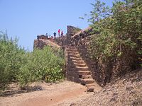 Ramparts
 -
 Artillery remains.
 -
 Walls.


References
[edit]- ^ "After years of neglect, Cabo de Rama fort to get facelift". The Times of India. 17 November 2021. Retrieved 8 October 2024.